how do I embed ar in my map?
Asked on 2024-08-16
1 search

To embed augmented reality (AR) in your map using Apple's technologies, you can leverage ARKit and visionOS. Here's a general approach based on the content from WWDC:
-
Object Tracking: Use object tracking to identify and track real-world objects in your environment. You can create a 3D model of the object you want to track and use ARKit to get its position and orientation. This allows you to anchor virtual content to real-world objects. For more details, you can refer to the session Explore object tracking for visionOS.
-
AR Quick Look: If you want to display 3D models in AR, you can use AR Quick Look. This allows users to view and interact with 3D models directly in their environment. You can use USDZ files and the
rel="ar"attribute in your web content to enable this feature. More information can be found in the session Optimize for the spatial web. -
Rendering with Metal: For more advanced rendering, you can use Metal to render 3D content and integrate it with the real world. This involves setting up a render loop and using trackable anchors to position your content. You can learn more about this in the session Render Metal with passthrough in visionOS.
By combining these technologies, you can create immersive AR experiences that enhance your map with interactive and informative virtual content.

Optimize for the spatial web
Discover how to make the most of visionOS capabilities on the web. Explore recent updates like improvements to selection highlighting, and the ability to present spatial photos and panorama images in fullscreen. Learn to take advantage of existing web standards for dictation and text-to-speech with WebSpeech, spatial soundscapes with WebAudio, and immersive experiences with WebXR.
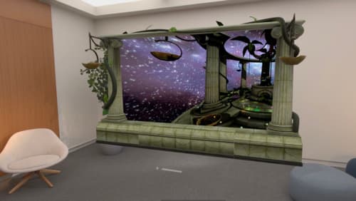
Bring your iOS or iPadOS game to visionOS
Discover how to transform your iOS or iPadOS game into a uniquely visionOS experience. Increase the immersion (and fun factor!) with a 3D frame or an immersive background. And invite players further into your world by adding depth to the window with stereoscopy or head tracking.

Create enhanced spatial computing experiences with ARKit
Learn how to create captivating immersive experiences with ARKit’s latest features. Explore ways to use room tracking and object tracking to further engage with your surroundings. We’ll also share how your app can react to changes in your environment’s lighting on this platform. Discover improvements in hand tracking and plane detection which can make your spatial experiences more intuitive.