how is mapkit used
Asked on 2025-08-19
1 search

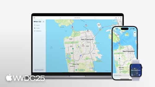
MapKit is used to enhance apps and websites with rich map data and functionality. At WWDC, Apple introduced several features and improvements for MapKit and MapKit JS. Here are some key ways MapKit is used:
-
Place Identification and Reference: MapKit allows developers to reference places using a unique identifier called Place ID. This identifier can be used to represent places in the MapKit framework and MapKit JS, and it remains valid over time, even as Apple updates place data. This is useful for referencing points of interest like museums, restaurants, and parks.
-
Displaying Place Details: Developers can use MapKit to display detailed information about places through place cards. These cards can show rich data such as operating hours and links to Apple Maps. This feature is available for both apps and websites, allowing for a consistent user experience across platforms.
-
Search and Geocoding: MapKit provides APIs for searching places and geocoding, which can be used to display information about a place or find places within a specific area. The MapKit server API offers enhanced search results with pagination.
-
Map Embedding and Customization: Developers can embed maps into their websites using MapKit JS, with options to customize the map's appearance and functionality. This includes adaptive maps that respond to the system's preferred color scheme.
-
Directions and Navigation: MapKit includes a directions API that helps users navigate between locations using various modes of transport, such as walking and driving. This API provides time and distance estimates and detailed step-by-step navigation.
For more detailed information on these features, you can refer to the sessions "Unlock the power of places with MapKit" and "Go further with MapKit" from WWDC 2024 and 2025, respectively.

Unlock the power of places with MapKit
Discover powerful new ways to integrate maps into your apps and websites with MapKit and MapKit JS. Learn how to save and reference unique places using Place ID. Check out improvements to search that make it more efficient to find relevant places. Get introduced to the new Place Card API that lets you display rich information about places so customers can explore destinations right in your app. And, we’ll show you quick ways to embed maps in your website with our simplified token provisioning and Web Embed API.
Go further with MapKit
Discover the latest updates to MapKit and MapKit JS. We’ll introduce a new type of directions — cycling — and show you how to enable 3D Look Around imagery on the web. Learn how the new Geocoding API supports conversion between coordinates and addresses, and how to use the Address Representations API to get the most appropriate address for a region. Then we’ll wrap it up with a new way of referencing places that ensures your app will work seamlessly with App Intents.

Code-along: Bring on-device AI to your app using the Foundation Models framework
Develop generative AI features for your SwiftUI apps using the Foundation Models framework. Get started by applying the basics of the framework to create an awesome feature. Watch step-by-step examples of how to complement the models with tools you build, stream results, and apply further optimizations for great performance.