What's new in mapkit
Asked on 2025-06-11
1 search

At WWDC, Apple introduced several new features for MapKit across different platforms. Here are some highlights:
-
Place Descriptor: A new type introduced in the Geotoolbox framework, allowing developers to supply structured information about a place. This can be used by MapKit or other mapping services to find rich data about a place.
-
Place ID: A unique identifier for places that can be used to reference map items in the MapKit framework and MapKit JS. This helps in maintaining consistent references to places over time.
-
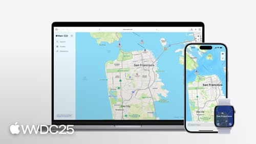
MapKit on watchOS: For the first time, MapKit APIs are available on watchOS, allowing for features like searching for nearby points of interest, getting routes using different transport types, and showing routes as overlays on a map with SwiftUI.
-
Cycling Directions: MapKit now supports cycling directions, which take advantage of paths and trails unavailable when driving and omit roads not suitable for bikes.
-
Lookaround Feature: This feature provides 360-degree interactive street-level imagery, which is now available in MapKit JS for web applications.
-
MapKit JS Enhancements: Simplified token provisioning and the ability to display place information using place cards, even if the app or website doesn't feature a map view.
For more detailed information, you can check out the sessions Go further with MapKit and Unlock the power of places with MapKit.

What’s new in watchOS 26
Discover the new features in watchOS 26 and learn how to integrate them into your watchOS and iOS apps. Explore the ARM64 architecture, and dive into the new design system. We’ll also share updates for widgets and insights on how to bring controls to Apple Watch.
Go further with MapKit
Discover the latest updates to MapKit and MapKit JS. We’ll introduce a new type of directions — cycling — and show you how to enable 3D Look Around imagery on the web. Learn how the new Geocoding API supports conversion between coordinates and addresses, and how to use the Address Representations API to get the most appropriate address for a region. Then we’ll wrap it up with a new way of referencing places that ensures your app will work seamlessly with App Intents.

Unlock the power of places with MapKit
Discover powerful new ways to integrate maps into your apps and websites with MapKit and MapKit JS. Learn how to save and reference unique places using Place ID. Check out improvements to search that make it more efficient to find relevant places. Get introduced to the new Place Card API that lets you display rich information about places so customers can explore destinations right in your app. And, we’ll show you quick ways to embed maps in your website with our simplified token provisioning and Web Embed API.